GPS
Global Positioning System (GPS) is a navigation system consisting of a constellation of 24 navigational satellites orbiting Earth, launched and maintained by the U.S. military. GPS satellites orbit at approximately 11,000 mi (17,700 km) above Earth, with orbit periods of approximately 10 hours. The final satellite was placed in orbit in 1993. Because each satellite houses cesium and rubidium atomic clocks that are periodically updated and synchronized with a ground station in Colorado, GPS receivers can decode signals from the satellites to calculate location and exact time.
To overcome shortcomings in earlier navigation systems, United States developed another system: Navstar (Navigation Satellite for Time and Ranging) Global Positioning System. This system consists of 24 operational satellites equally divided into six different orbital planes (each containing four satellites) spaced at 60° intervals. The new system can measure to within 33 ft, (10 m), whereas earlier systems (e.g. Transit) were accurate only to 0.1 mi (0.16 km). Military users have access to systems with still greater accuracy.
Ground users commonly rely on GPS receivers. The receivers are small, hand-held devices that receive and decode GOS satellite signals. Small differences in the time lapse between signal receptions from three orbiting satellite signals (allowing triangulation of signals) are mathematically converted to latitude, longitude, and altitude. Sophisticated hand-held units are capable of determining latitude and longitude to a thousandth of an arc minute; these units show changes in reading as vehicles move very short distances).
With GPS, two types of systems are available with different frequencies and levels of accuracy. The Standard Positioning System (SPS) is used primarily by civilians and commercial agencies. As of midnight, May 1, 2000, the SPS system became 30 times more accurate when President William Jefferson Clinton ordered that the Selective Availability (SA) component of SPS be discontinued. SA was the deliberate decrease of accurate positioning information available for commercial or civilian use. The SPS obtains information from a frequency labeled GPS L1. The United States military has access to GPS L1 and a second frequency, L2. The use of L1 and L2 permits the transfer of data with a higher level of security. In addition to heightened security, the United States military also has access to much more accurate positioning by using the Precise Positioning System (PPS). Use of the PPS is usually limited to the U.S. military and other domestic government agencies.
Long before the space age, people used the heavens for navigation. Besides relying on the sun, moon, and stars, the early travelers invented the magnetic compass, the sextant, and the seagoing chronometer. Eventually,

radio navigation in which a position could be determined by receiving radio signals broadcast from multiple transmitters came into existence. Improved high frequency signals gave greater accuracy of position, but were sometimes blocked by high terrain and could not bend over the horizon. This limitation was overcome by moving the transmitters into space on Earth-orbiting satellites, where high frequency signals could accurately cover wide areas.
The principle of early satellite navigation was relatively simple. When a transmitter moves toward an observer, the Doppler shifted radio waves have a higher frequency, just like a train's horn sounds higher as it approaches a listener. A transmitter's signal will have a lower frequency when it moves away from an observer. If measurements of the amount of shift in frequency of a satellite radiating a fixed frequency signal with an accurately known orbit are carefully made, the observer can determine a correct position on Earth.
The United States Navy developed such a system, named Transit, in the late 1960s and early 1970s. Transit helped submarines update their on-board inertial navigation systems. After nearly ten years of perfecting the system, the Navy released it for civilian use. However, a major drawback to Transit was that it was not accurate enough; a user had to wait until the satellite passed overhead, position fixes required some time to be determined, and an accurate fix was difficult to obtain on a moving platform.
Both Transit and Navstar use instantaneous satellite position data to help users traveling from one place to another. But another satellite system uses positioning data to report where users have been. This system, called Argos, is a little more complicated: an object on the ground sends a signal to a satellite, which then retransmits the signal to the ground. Argos can locate the object to within 0.5 mi (0.8 km). It is used primarily for environmental studies. Ships and buoys can collect and send data on weather, currents, winds, and waves. Land-based stations can send weather information, as well as information about hydrologic, volcanic, and seismic activity. Argos

can be used with balloons to study weather and the physical and chemical properties of the atmosphere. In addition, the system is being perfected to track animals, including marine life.
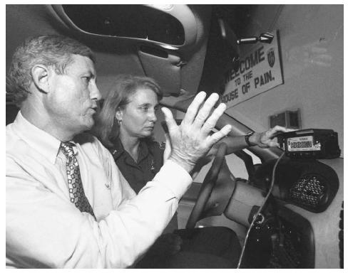
In addition to GPS use in weapons systems and for navigation, use of the GPS system in everyday life is becoming more frequent. Equipment providing and utilizing GPS is shrinking both in size and cost, while it increases in reliability. The number of people able to use the systems is also increasing. GPS devices are being installed in cars to provide directional, tracking, and emergency information. Emergency personnel can respond more quickly to 911 calls using to tracking signal devices in their vehicles and in the cell phones of the person making the call. As technology continues to advance the accuracy of navigational satellite and without the impedance of Selective Availability, the uses for GPS will continue to develop.
█ FURTHER READING:
BOOKS:
Balazs, G. H. "Homeward bound: satellite tracking of Hawaiian green turtles from nesting beaches to foraging pastures." Proceedings of the Thirteenth Annual Symposium on Sea Turtle Biology and Conservation. U.S. Dep. Commer., NOAA Tech. Memo. NOAA-TM-NMFS-SEFSC-341, (1994):205–208.
El-Rabbany, Ahmed. Inroduction to GPS: The Global Positioning System Norwood, MA: Artech Publishing, 2002.
ELECTRONIC:
Dana, Peter H. "Global Positioning Overview" The Geographer's Craft Project. May 1, 2000. University of Colorado. < http://www.colorado.edu/geography/gcraft/notes/gps/gps_f.html > (March 29, 2003).
Comment about this article, ask questions, or add new information about this topic: